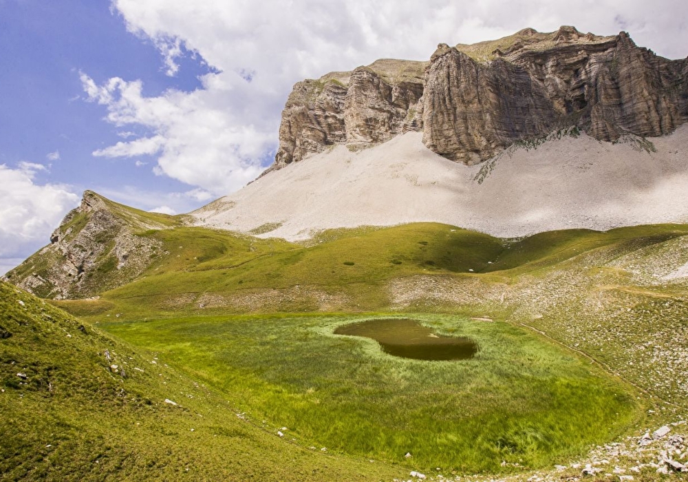
If you're brave enough to climb up to this austere mineral spot, you'll find a small high-altitude lake, unique in a limestone environment, a veritable oasis in its stone setting, populated by alpine newts and cottongrass.
> The site can be very busy at weekends and on public holidays. Choose the right day and/or time for your comfort and that of your host site.
1/ From the parking lot, continue along the road towards the bottom of the valley. At Champ de la Commune (alt. 1267m) go straight on until you reach Ravin du Fleyrard (alt. 1267m).
Coordinates: (44.6915399, 5.7789403)
Distance from starting point: 9 km
2/ Turn left on the steep path to take the track on the left which climbs more gently to the Cabane du Fleyrard crossroads (alt. 1,600m).
Coordinates: (44.6929636, 5.7925588)
Distance from starting point: 1 km
3/ Climb the path on the left. It rises on a spur in short switchbacks (steep sections and not always visible tracks: follow the signs!), then reaches the flat where the lake is located. Go around the lake to the left, passing along the water's edge, then climb up towards the bottom of the cirque to reach the Lac du Lauzon junction (alt. 1961m).
Coordinates: (44.6964414, 5.8060199)
Distance from starting point: 3 km
4/ Take the path on the left that climbs to the foot of the scree slopes and cliffs of the tête du Lauzon. Change to a stony descent to reach the Col des Aurias.
Coordinates: (44.7037522, 5.8088523)
Distance from starting point: 4 km
5/ Continue downhill on the path that swings to the right on the Trièves side to reach the Col de la Croix (alt. 1497m).
Coordinates: (44.7029592, 5.7916004)
Distance from starting point: 6 km
6/ Take the path on the left, which becomes quite steep in the woods as you leave the meadow. At Ravin du Lavensas (alt. 1384m), leave the path on the left and continue down a flight of stone steps. At the foot of the descent to Saboyer (alt. 1258m) take the track on the right to reach Les Granges des Forêts (alt. 1214m) and take the road on the left back to the parking lot.
Coordinates: (44.7003562, 5.7804996)
Distance from starting point: 7 km
Le vallon de la Jarjatte est un site classé, caravaning interdit. Site très fréquenté certains week-ends et jours fériés : choisissez le bon jour et la bonne heure pour votre confort et celui du site qui vous reçoit !
Free access.
Information updated on 05/05/26 by the Pays Diois Tourist Office