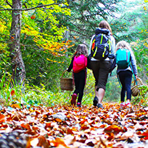
Because we thought that you would be bound to have confidence in enthusiastic walkers like yourselves and because these are regular walkers who know every corner of their area.
Because although they have got used to these landscapes but are still knocked out by them.
Because their preferences will surely also be yours.
We offer their thoughts on a shortlist of great walks in the Pays Diois.
The Office de Tourisme cares about its visitors, so it advises you not to overestimate your fitness as some of the circuits are difficult if not severe. If you are in any doubt, you can tackle these walks in safety with a mountain leader or mountain guide (guide de haute montagne) who will be able to assess your ability regarding the route in question.
We also feel we need to remind walkers that appropriate equipment and a detailed local map are necessary for these walks.
One last thing: our mountain pastures are frequented by flocks of sheep and their protection dogs. Find out before you set off because in some areas no other dogs are not allowed. Also, if you are walking on your own, find out what you should do if you come across these dogs.
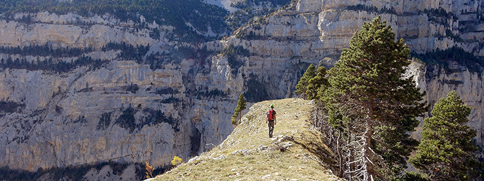
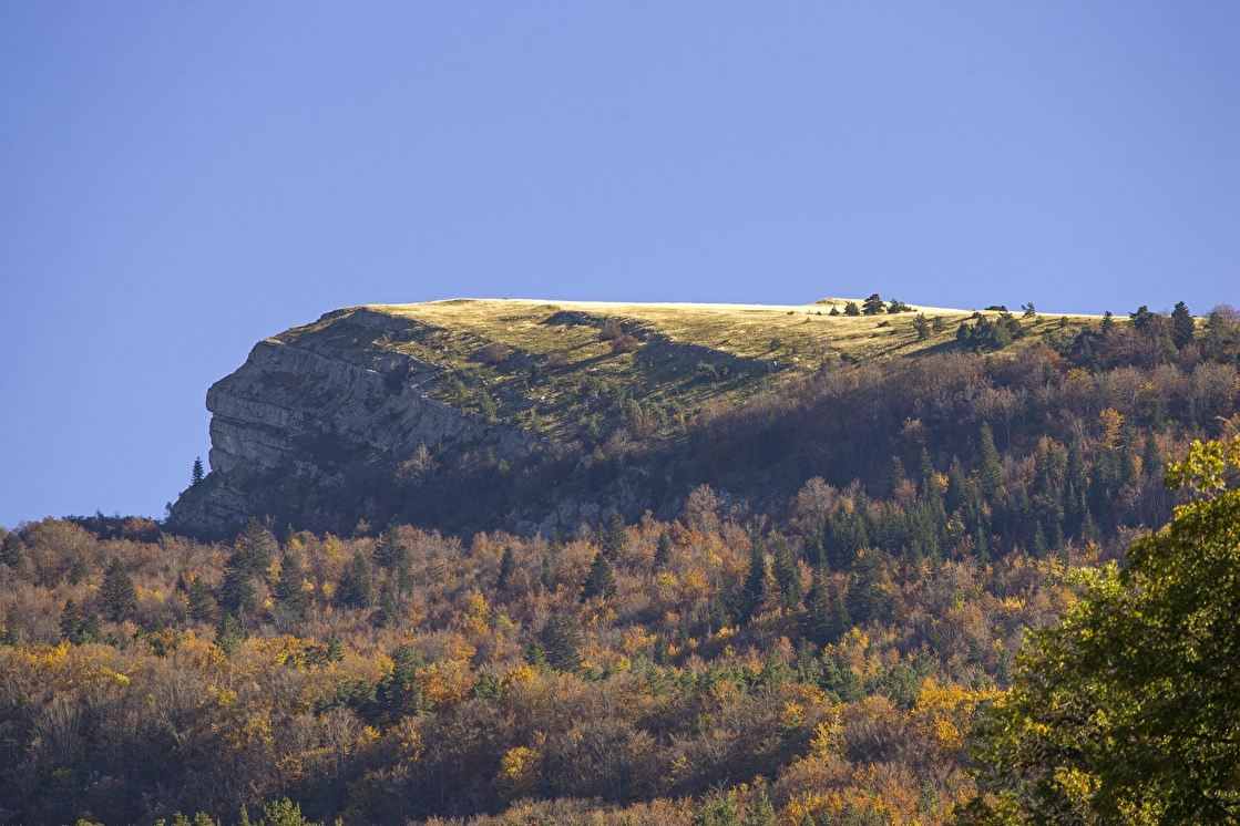
This is THE mountain for local people, the landmark which watches over their daily lives. The southern and abrupt bastion of the Vercors, the Glandasse towers over 1500 metres above the town of Die.
This is one of the largest upland open wastes in Europe, linked to the ‘Réserve Naturelle des Hauts Plateaux du Vercors’ and a paradise for fauna and flora, the transhumant flocks of sheep and not forgetting walkers who are staggered by the immensity of it. Walkers are allowed in but are invited to leave their normal expectations behind, including mobile phone reception!
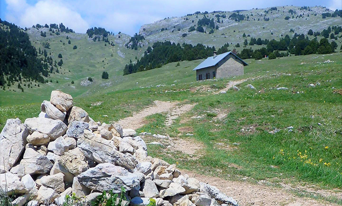
Start at the abbaye de Valcroissant (Die)
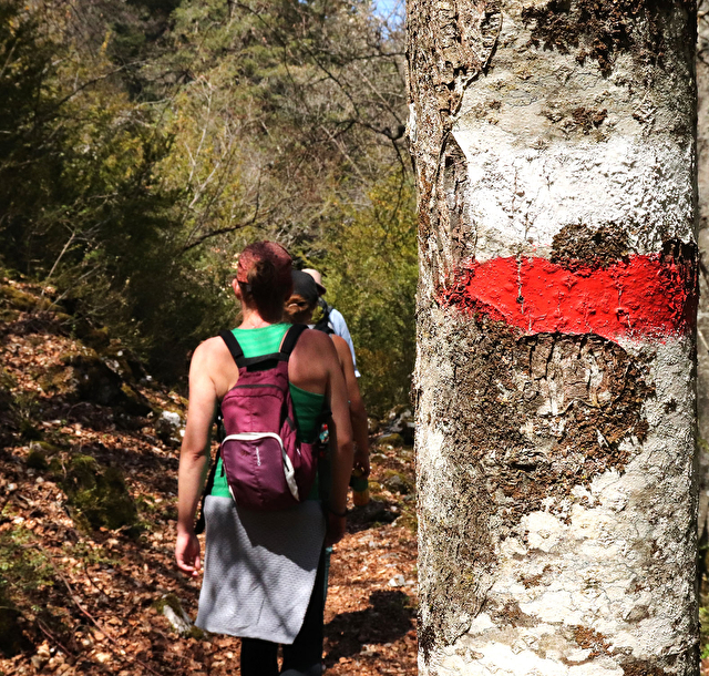
A difficult circuit partly way-marked in yellow and green, the colours of the Vercors Park
Length : 7 h
Distance : 15 km
Total height : 1400 m
Professional guide recommended
I am passionate about walking and mountaineering, both in summer and in winter and I have a number of favourites such as the Plateau de Solaure and the ‘Réserve Naturelle des Hauts Plateaux du Vercors’, from Ambel to the Grand Veymont. But my favourite walk is the Dôme du Glandasse with its plunging 360° views over the Diois, returning via the ‘Sentier du Paradis’ and the abbey. A walk for walkers in good shape!
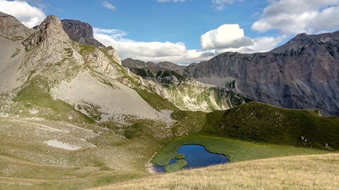
Perched below the highest summit in the Drôme, the Rocher Rond (2453m), the Lauzon Lake is an unusual feature.
This is the only high-altitude lake in this limestone area, yet limestone absorbs water. It overlooks the Jarjatte valley, known for its picturesque landscapes.
In an unworldly setting, the climb makes for a fine geological walk.
Even though it’s not very big, the lake is a very rich environment, with its population of alpine newts and silky cotton grasses.
Start at Jarjatte (commune of Lus-La-Croix-Haute)
A difficult circuit, way-marked in the Parc du Vercors yellow and green colours
Length : 5 h
Distance : +9,3 km
Total height : 800 m
Dogs not allowed from du 15/06 to 15/10
I like the end of the valley, because it’s a challenge to get there! Those brave souls who climb up as far as this geological site will discover an oasis in the heart of the rocky landscape! Each time I emerge from the forests, the beauty of the landscape takes my breath away. However, from that point onwards, it’s the end of the stroll, we attack a cruel and sudden slope, eroded by the passage of flocks of sheep. This will set your heart beating, even if no actual danger is involved. But your efforts will definitely be rewarded!
In the lee of the Dent de Die, after the ascent through the woods, the wide-open spaces of the Réserve Naturelle des Hauts Plateaux offer a well-earned prize.
This is where the transhumant flocks have to pass. Here sheep are masters of the pastures and are spread out in little groups accompanied by the sound of their bells.
The main feature here is the incredible survival of the remains of Roman stone quarries, over which the pollarded tree, the iconic figure of the ‘plaine de la Queyrie’, seems to stand guard.
With a bit of luck, we will be able, during the walk, to watch the ballet of vultures and ibex.
Start at Fournaire (commune of Romeyer)
Difficult route, way-marked in the yellow and green colours of the Parc du Vercors
Length : 5h30
Distance : 15,2 km
Total height : 685m
Dogs not allowed
My wife and daughters are also present on our favourite walk: the climb up to the Roman quarries. We do it mainly in spring when the flocks have not yet feasted on the little flowers and our friends the marmots are in attendance. Having passed the steep Pas de Chabrinel, we often wonder at how the Romans managed to get their columns weighing several tons down towards the valley!!!
Conseil de l’Office de Tourisme : éviter les Hauts Plateaux par temps de brouillard car les repères y sont peu nombreux. Les anciens taillaient de grands pins, à distance les uns des autres. Ici, « l’arbre taillé » est entretenu par les bergers depuis des générations.
From the « chèvres » path, ascend through the undergrowth.
The route then becomes more exciting, one section being sculpted out of the mountainside, which gives your progress a satisfying feeling.
You even get to go through a pedestrian tunnel excavated by the workers tasked with replanting trees on the North slopes. A « via ferrata » is provided, using a cable to give additional protection.
When you emerge, the path, which is almost flat, becomes like a rock pavement and, after a long stretch, climbs hard up to the Col du Pinet.
From there the path follows the side of the mountain and reaches the summit meadow where the 360° panoramic view will take away what little breath you had left.
The descent allows us to appreciate the verticality of this mountain.
Start from les Gallands (commune of Menglon)
Circuit way-marked in yellow
Length : 5h30
Total height : 850m
Distance : 12 km
Dogs must be kept on leads
Firstly, you get to discover a typical hamlet at the meeting point of little Diois valleys. To begin with the going is hard but very soon we gain height and one is reminded of all those mule paths that used to abound. Once in the woods, it’s steep and goes on a bit! But how pleasant it is to walk through the box bushes and feel the summit is not far ahead. We emerge into a mountain pasture and there we are, as if on a tiny island at the heart of the Diois. I think this is the finest 360° view there is over the Diois!
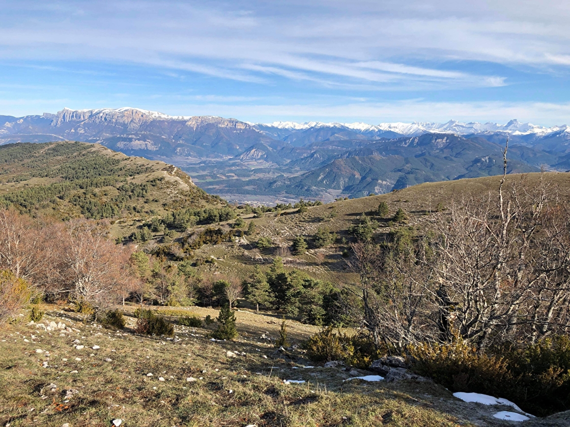
This observation point is, without doubt, the central node of the geological diversity of the area.
It overlooks four landscapes: the agricultural chess board of the Trièves, the limestone wall of the Vercors, the rounded off tops of the Haut Diois and the steep-sided Dévoluy.
This pyramid-like mountain top is also a windy place!
The Col de Vente-Cul is not somewhere to hang around when it’s windy! Giono said of the col in L’Iris de Suse : « The pastures of the Jocond occupied the highest parts of the mountain. These are vast areas of solitude ».
Start at the Col de Grimone (commune of Glandage)
Both legs are difficult. Way-marked in green and yellow
Length : 4h30
Distance : 8,2 km
Total height : 757m
Dogs not allowed from 15/06 au 15/09
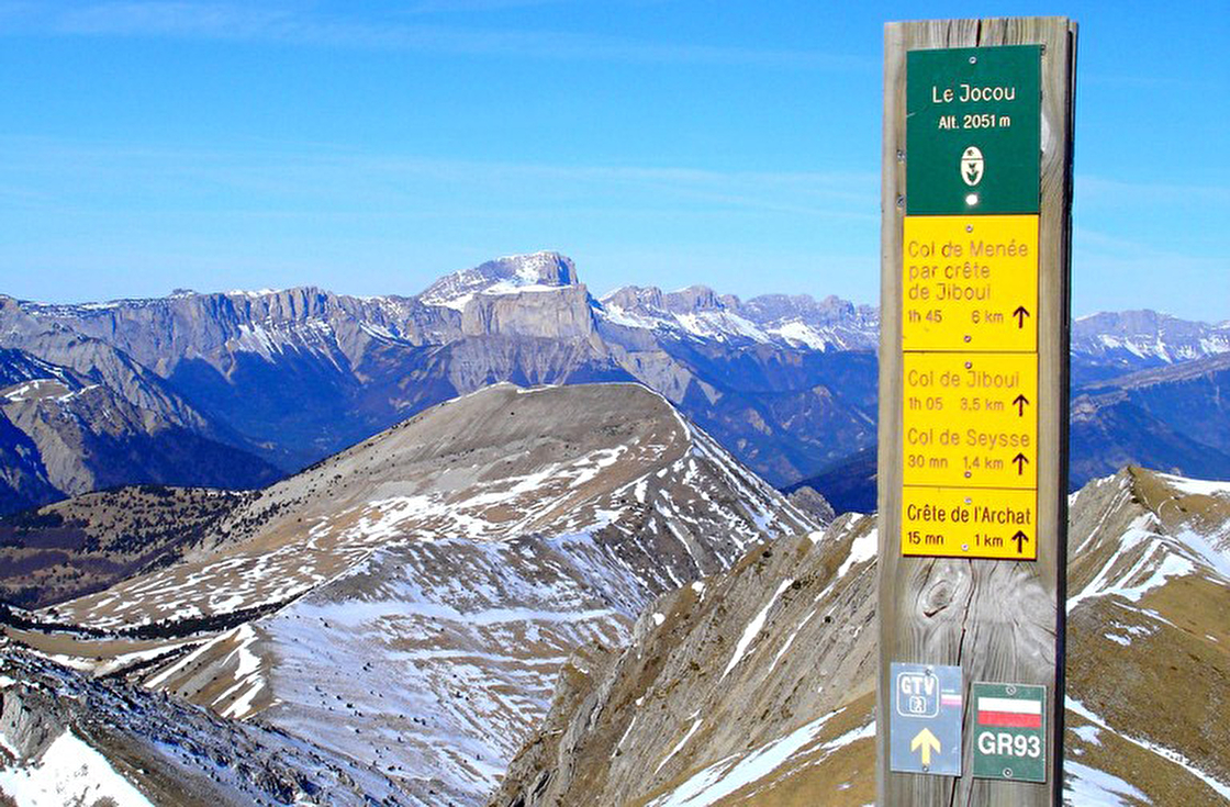
After 15 years spent travelling around the Park as part of my job, putting in place the way-marking and the sign-posting for walkers, I would choose the Jocou. This summit, accessible for all walkers in a day and in good weather, in my mind offers one of the finest 360° views of the Pays DIois. This is mountain pasture and I am regularly in this area in summer to familiarise visitors with the presence of guard dogs that protect the sheep.
Michel Former eco-ranger with the Parc Naturel Régional du Vercors
Information from the Office de Tourisme : In order to limit the contact between walkers and sheep guard dogs on the privately owned pasture of the Vallon des Pâtres, the Communauté des Communes du Trièves has removed way-marking from the path between the Col de Seysse and the Crête de l’Archat. An alternative route has been put in place. Get more information before setting out.
#6
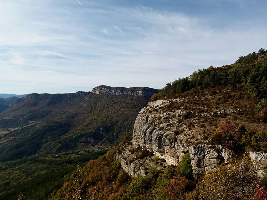
The Plateau de la Chau via la Crête des Ruelles – 1399 m
This line of ridges has something Provencal about it due to its pastoral economy, its apricot and plum orchards and its lavender fields.
It contains some geological features, such as the Col du Fau, a cave system which can be explored with a head torch, or the crevasses of the Pas du Pousterlou, produced by the slippage of limestone layers over the underlying shales.
Within the bounds of the two Parcs Naturels Régionaux, the Crête des Ruelles offers a splendid view over the Vercors to the North and the Baronnies to the South.
I like to go up near the ‘altiport’ where I can sit down to admire this arid plateau, dotted with lavender fields, barns and even a small lake full of fish. And all this just above my village. The track which leads to it offers the shade of mature oaks and the protection of stone walls. The higher you get the more challenging the walk becomes, with a short difficult passage, but it offers determined walkers a splendid view with an end of the known world feel to it!
At the frontier between the Buëch and the haut Diois, the vegetation is very varied in this outstanding area for flowers and also where lavender rubs shoulders with wormwood.
The height of these twin peaks (in relation to those around them), makes them a superb viewpoint over the Baronnies, the Diois, the Buëch and the Dévoluy.
You won’t meet many people; this is a walk on the wild side. A fine circuit which is worth the journey, just for the view.
Start at the resort (commune of Valdrôme)
Middle of the range walk, way-marked in yellow
Length : 4h30
Distance : 13km
Total height : 650m
Dogs on leads allowed
I would recommend spending a night in the Pré Pourri cabin to take, early the following morning, the path which gently rises under the majestic Sarcéna pine woods, a relict forest from the Ice Age, then through flower strewn pastures to reach the highest point in the upper Drôme valley: le Duffre, which already prefigures the Hautes Alpes. You can extend your walk to take in the Laup ridges (+1h30) if the remarkable views tempt you. The return leg crosses the lower part of grasslands where you can see chamois and marmots.
One foot in the Drôme and one in the Isère, Tête Chevalière is known for its view over the Mont Aiguille, one of the 7 wonders of the Dauphiné.
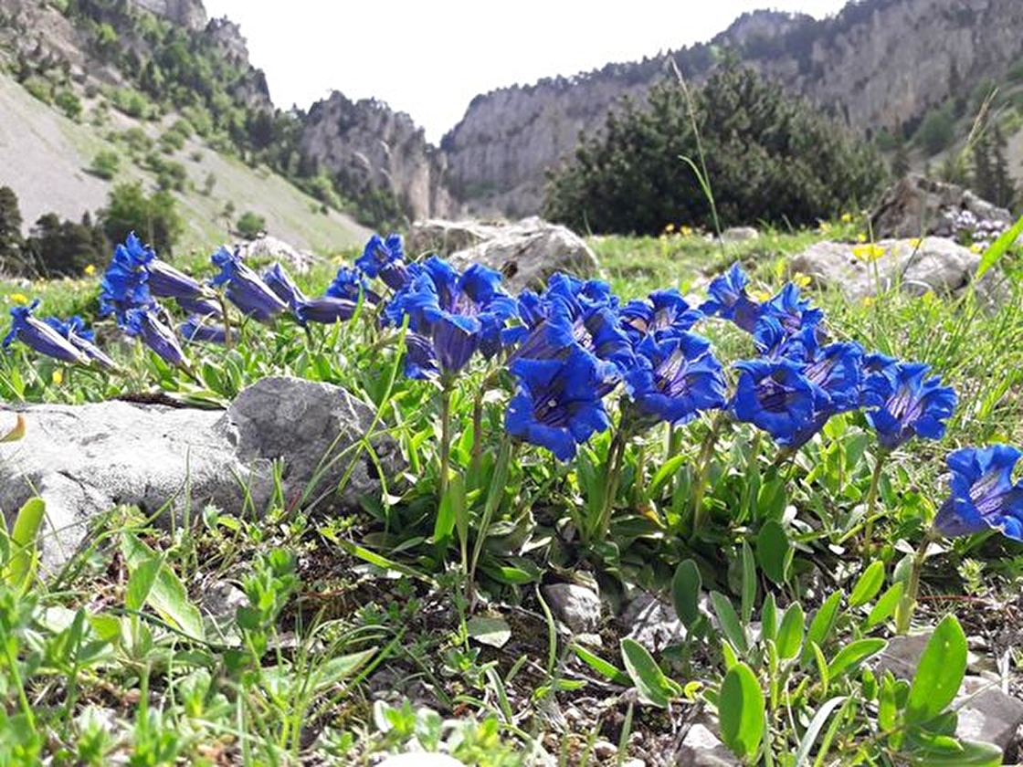
Set off for the kingdom of bee orchids in the Vallon de Combeau, a spring-time jewel covered in orchids in May and June.
This is one of the points of entry into the Réserve Naturelle des Hauts Plateaux du Vercors, the most extensive such area in metropolitan France.
17 000 hectares, with no roads or houses and which only resonate to the cry of marmots.
This is virgin space, and intense space, dedicated to grazing and walking.
Start at the Combeau car park (commune of Châtillon-en-Diois)
Yellow and green way-marking until the Pas de l’Essaure
Length : 4h
Total height : 570m
Distance : 11,3km
Dogs are not allowed
I have roots in the Pays Diois, so what a pleasure it is each year to introduce my daughter to these wonderful walks. We particularly like the Vallon de Combeau: its vast pastures, its flowers, its panoramic views over the Alps and the singular beauty of the Mont Aiguille!
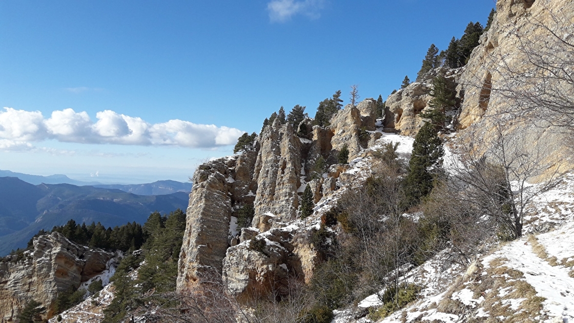
A mountain with a strange name …. This little desert in Drôme Provençale is very sparsely populated with only 2 inhabitants per sq km and features tormented geology, far horizons and native flora.
This asymmetrical summit offers an arid slope and an abrupt rock face overlooking a dense wood and a large summit plateau, blued with wild lavender.
On arriving at the edge of the impressive cliff, you will enjoy 360° views.
Start at the Col de Vache at Volvent
Both legs way-marked with wooden posts
Length : 4h
Total height : 870m
Distance : 12km
Dogs are not allowed
I chose this walk because of its unspoilt nature and wide wild expanses and yet it is easy to get there. In summer you come across flocks of sheep and if you lift your head, with a bit of luck you will see the ballet of vultures gliding about between the Baronnies and the Vercors. When the sky is clear the views from the summit extend as far as the Mont Ventoux and the Mont Blanc. As a child I spent some wonderful moments here with my family or with the St Nazaire le Désert primary school.
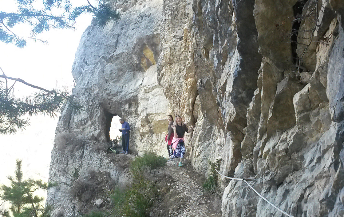
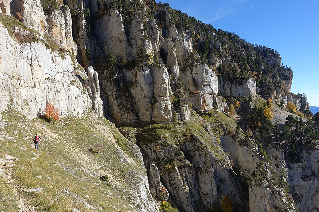
Without doubt one of the stiffest walking challenges in the Vercors Sud and not suited to most walkers. This dizzying walk contains two technical exposed sections.
But this tight-rope walkers’ passage through the cliffs offers sensational viewpoints set in an incredibly vertical environment.
Ibex, masters of this space, are in their element and manage to climb with infuriating ease.
Start in the hamlet of Archiane (commune of Châtillon-en-Diois)
Very difficult circuit, not way-marked and not to be taken lightly
Length : 6h30
Total height : 900m
Distance : 16km
Only for experienced walkers who are comfortable with exposure and dizzying height. Roping up is necessary in one or two places, not to be undertaken without a professional guide
Dogs are not allowed
This is the walk which has impressed me most, with its ‘vires’ (narrow contour paths) nestled within the imposing cliffs of the Cirque d’Archiane, typified by vultures and the vertigo inducing heights of this high level walk. A must! Not everyone can do this and the presence of a guide was necessary for me to benefit from this experience in a safe manner.