Sport
Le col de la Maure
Establet
🌿The Diois is ready to welcome visitors again. The wildfire is now over and tourist activities are open as usual. Only the Solaure, Justin and Aup mountain areas remain closed to the public.

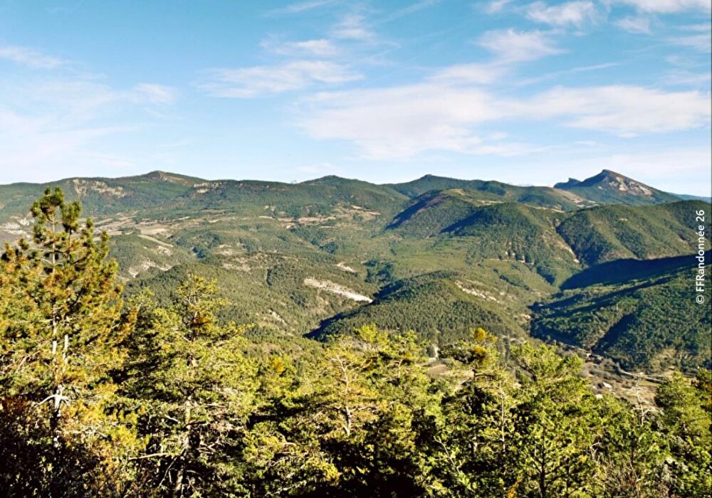
Immerse yourself in the wild oak woodland of the black marl country known here as "roubines", and emerge on the ridge with a feeling of freedom given by this ocean of greenery as far as the eye can see in the Establet, Motte-Chalancon and Rottier valleys.
1/ From the town hall parking lot, head north on the D61. After the last house and the bridge, turn left at the "Establet" sign (774 m). Continue along the track, which rises for 2 km before reaching the Sueil crossroads (970 m).
2/ Take the left-hand path. It climbs steeply through the undergrowth to reach the Col de la Maure (1,159 m).
> 3/ Access the summit of Montagne des Ruelles (1,400 m) via the ridge path on the right (2 km and 240 m additional climb).
3/ Cross the pass and take the wide path down to the Gaudissard crossroads (970 m). Take the track on the left. At the second right-hand bend, take the track on the left. It runs along the top of the fields, then descends to the right (south) for 250 m.
4/ At the fork in the road, take the left-hand path. When level, it passes through a wood of oaks, then descends to the Valdoule farm. Take the access road on the left for 50 m to the square rock, then turn left onto the path along the edge of the meadows to reach the Col de la Sausse (845 m).
5/ Opposite, slightly left, plunge into the valley of the Ruisseau d'Establet (follow the markings on this sometimes damp slope!) The path on the side leads to Bas-Establet. Continue along the access road and turn left onto the D61, using the roadside verges to reach Establet.
Free access.

Information updated on 25/07/26 by the Pays Diois Tourist Office